A map showing Super Typhoon Haiyan superimposed over the continental United States has gone viral. It's all wrong.
Here's the image, supposedly (actually?) created by the Red Cross:
Now, here's the Philippines over the United States:
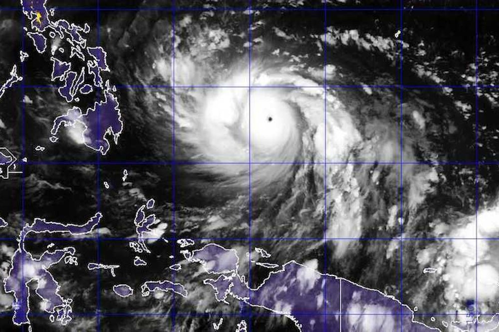
And here's Haiyan with respect to the Philippines:
So Haiyan was large, but it was not even CLOSE to the size of the United States. The central dense overcast—the strong convection ringing the eye that's colored black in the hoax—is only about the size of the southern most island of the Philippines, not the entire southeast of the United States.
When I last checked (not long before landfall), hurricane force winds only extended about 50 or 60 miles from the eye. It's one of the most intense storms ever, but it wasn't a continental sized monstrosity.
So here's Haiyan in full context:
Updated 4:03PM:
Here's another look from the University of Wisconsin's Space Science and Engineering Center. The image on the left superimposes an image of Haiyan over the Gulf of Mexico. For comparison, an actual image of Hurricane Katrina (not at its greatest size, but at its greatest intensity) is on the right:
Update 4:07PM:
@bran_dj superimposes my original satellite image and map of the United States
Update 5:06PM: The Red Cross issues a correction. They neglected to scale the image:
Earlier today, we posted a map of Typhoon Haiyan comparing the size of the storm to geography of the United States. In the process of making the rest of our maps for our operations in the Philippines, we made a mistake with this one and it was not to scale. We always strive to provide the most accurate information possible and we missed the mark with this one-literally. We would like to apologize for this mistake and thank the people who kindly pointed this out to us. We would like to thank everyone for their patience and their continued support of the American Red Cross. We are working on revising the image so it is correct.
